Sandy Hook Bike Path
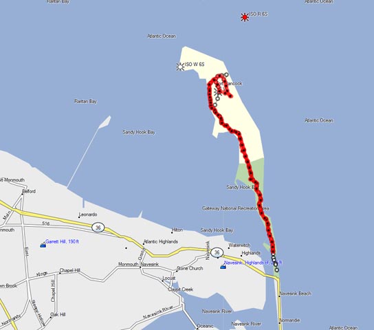
The Sandy Hook bike path (recorded on GPS)
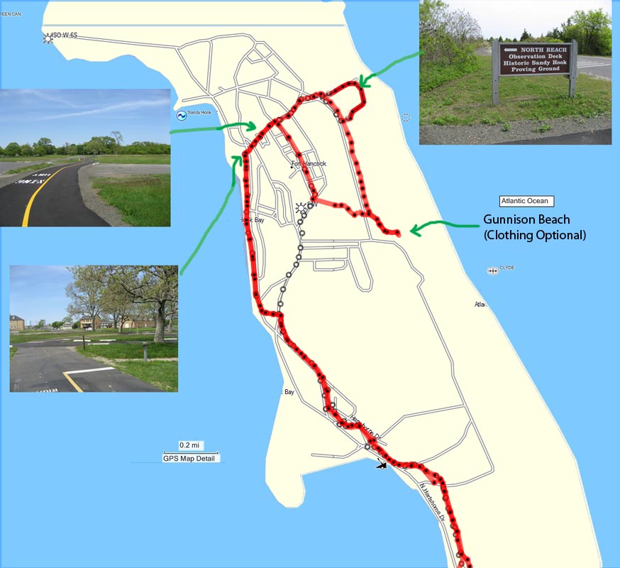
Detail of the north end of the Sandy Hook path
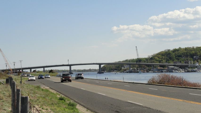
The new bridge on Route 36 leading to the park entrance
Description:
The Sandy Hook bike path opened in 2004 and was extended in the spring of 2009. It runs the length of the Sandy Hook penninsula, giving views of both the bay and beaches and across the bay to Manhattan and Long Island. There are unique flora and fauna, a picturesque lighthouse, respites from the sun and heat through small woodsy segments, and interesting old military installations.
Length:
The round trip shown in the map diagram is 12 miles.
Surface and safety:
The surface is asphalt, smooth and about 10 feet wide. Biking is completely safe within the park, although collisions with heedless pedestrians on the path are apparently common.
The new bike path has made Sandy Hook biking much more pleasant and safe. In previous years bikes had to share the road with cars, and on summer weekends the drivers could be very discourteous, even by New Jersey standards, as they fought over the fast-dwindling parking spaces. I've had cars full of beer-guzzling teenagers honk their horns and yell to try to startle me as they passed. Twice I had bottles thrown at me, and one time the bottle jammed in the front spokes, almost spilling me into dense traffic. Really funny. The bike path has ended that source of mayhem.
If you can time a summer ride to arrive at the park entrance at about 11:30am on a weekend, the park will often be closing to cars and you'll have the roads to yourself.
Points of interest:
The beaches and military remnants are noteworthy. There are historical markers and tours of the missile sites. At the midpoint there is a refreshment area with an upstairs outdoor restaurant, the Sea Gull's Nest. In summer evenings "God Bless America" is sung as the sun sets over the bay below. The officer's houses lining the northern tip are a pretty sight, although the houses are now in very poor condition. Particularly from the northern beaches there are spectacular views of Manhattan, the Verranzano Narrows Bridge, Coney Island, Brooklyn, and Long Island. These views are usually clear on weekends and holidays, but seldom in the misty pollution of weekdays.
The one question I am most often asked from passing cars is, "Where is the nude beach?" In fact, this is the only question I am ever asked. In case you want to go there, or alternatively to avoid it, the nude beach is Gunnison Beach, or Area G. Actually it is a "clothing optional" beach, but this is not an option that many people choose. On a summer weekend there are usually about six thousand nude bathers at this beach. It is said to be the most popular nude beach in the world, but few people seem to know about it (a contradiction, I know!). The majority of all the money that the park makes from admissions is for people going to the nude beach. At the north end of this beach is a small section for clothed bathers, but no one is ever there. At the south end the gays congregate.
The bike path ends at Gunnison Beach, provided you follow around the tip of the park and back to the south as shown on the map above.
What's not to like:
The path is too short and flat for much exercise. Some serious bikers avoid the path because on summer weekends there are too many pedestrians, slow bikers, and roller bladers in the way. Beachgoers cross the path at several places, and habitually pay no attention whatsoever to oncoming bikes. The rangers tell me that there have been a number of collisions. Though the path itself is flat, the wind is strong and can make biking unpleasant sometimes. The wind is sometimes from the north in the morning, but nearly always turns around in the afternoon and can become a gale in your face as you exit to the south. With luck you can have the wind in your face both coming and going. One of the nice things about the bike path is that on the northern portion of the route the wind is shielded. However, in the last 2.5 miles, from the Sea Gull's Nest area to the entrance, bikers are completely exposed to the wind. I tell myself that it's good exercise, but it isn't fun there heading south on a typical afternoon.
Parking:
After Labor Day and before the Memorial Day weekend, parking is plentiful and free. There is a parking lot immediately on your right at the entrance where the bike path begins.
During the summer season parking is entirely a different matter. First, there is a ten dollar entrance fee, even if you are planning on parking right there at the entrance. Moreover, you will be lucky to park anywhere. On a good summer weekend the park is closed when all parking spaces are filled. This usually happens around 11:30am to noon. Cars full of people driving from New York City are turned away, and chaos reigns in the vicinity as desperate drivers try to find anywhere to leave their cars. There is virtually no parking anywhere near the beach from the Sandy Hook entrance south for a distance of about five miles. Fortunately, with a bike you have some flexibility about parking. The closest free parking coming from the north on Route 36 is in Atlantic Highlands down the hill immediately before the bridge at the park entrance. The hill is steep, and you may have to walk your bike back up, but you will at least save ten bucks and have a guaranteed parking space.
There is still another possibility for free parking. There is at least one parking area on Sandy Hook that is designated as "free". This is Area M, which is at the north end of the park adjoining a picnic area but not a beach. The theory is that if you tell the person at the toll booth that you are going to the free area, then you don't have to pay. You don't get a sticker to display, and would be subject to a fine if you park in any of the other areas. I've noticed that Area M often has open parking spaces even on summer weekends when the Hook is filled. However, I'm not sure I'd count on this. I've gotten conflicting emails from readers, some of whom say this doesn't work, and others say that it does.
Getting to Sandy Hook from New York City:
If you're driving from New York City, it takes roughly an hour, although summer weekend traffic can often be difficult. Take the New Jersey Turnpike south to Exit 11, Garden State Parkway. Then take the Parkway south to exit 117 and follow Route 36 south to the Sandy Hook entrance.
There is a ferry service from New York City to the Sandy Hook via Seastreak Ferry. This is the so-called "fast ferry", which goes from the dock at East 35th street. Starting at the end of May there are two trips a day to Sandy Hook, one at 8:45am and the other at 11:00am. There is one return trip at 4:10pm. (Check these times on their web site.) Once you depart the ferry, there is a bus that takes passengers to the most popular beaches. Riders should check with the Seastreak web site to be sure that the ferry is still in operation to Sandy Hook.
In past years there has been a bike rental place at the ferry dock on the Hook. There has been another rental place situated in parking lot E for those who drive.
Photos and comments: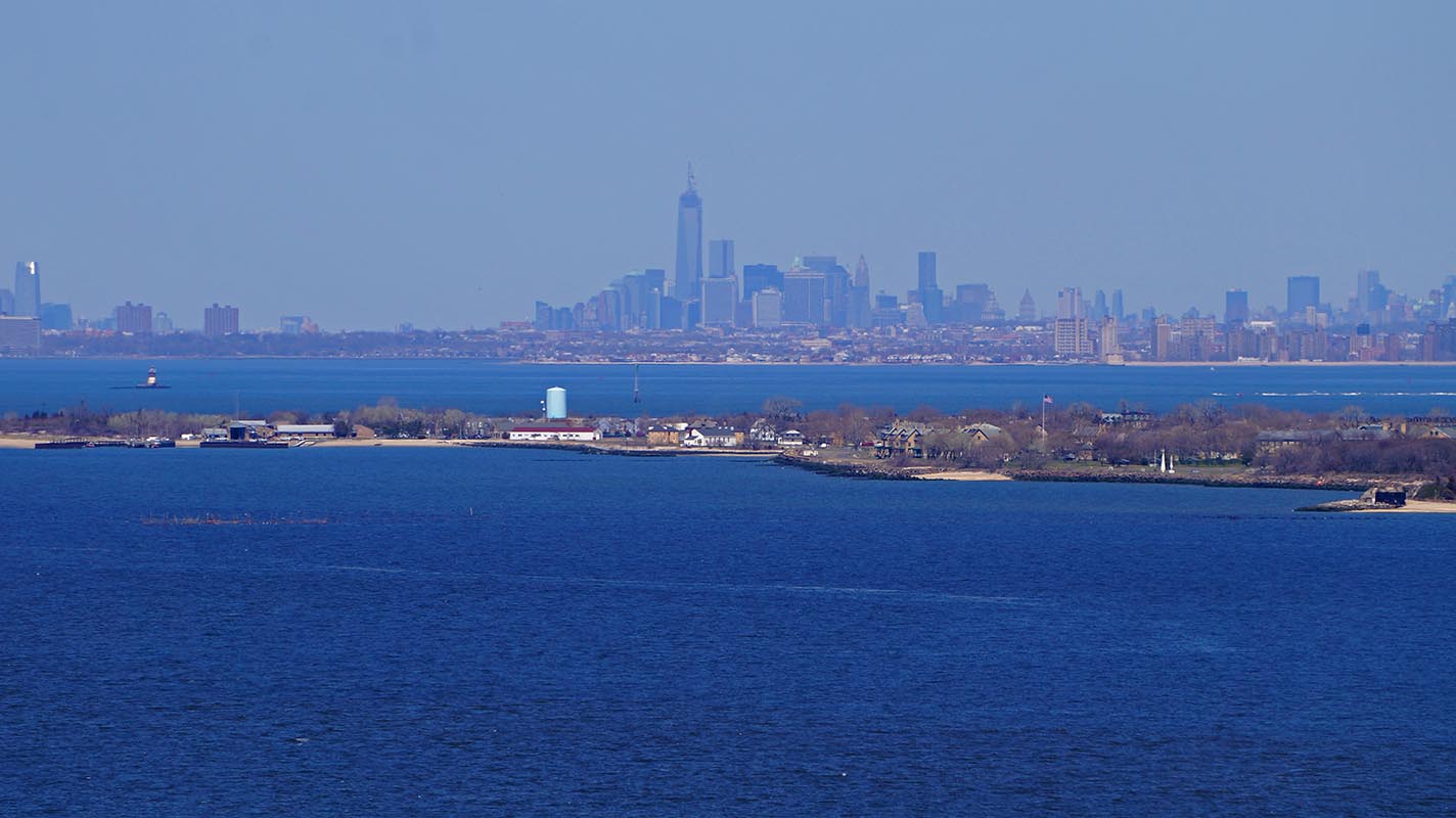
The Sandy Hook Penninsula viewed from Scenic Drive in Atlantic Highlands
Entrance to Sandy Hook Park -- Bay on the left and ocean on the right
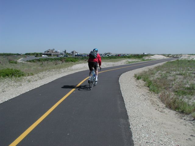
A wide, smooth path leads towards the Sea Gull's Nest refreshment area
Away from the madding crowd
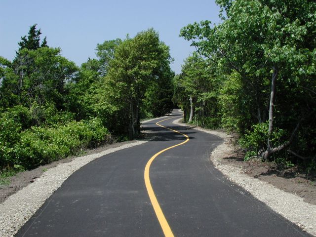
The path has pleasant zigs and zags
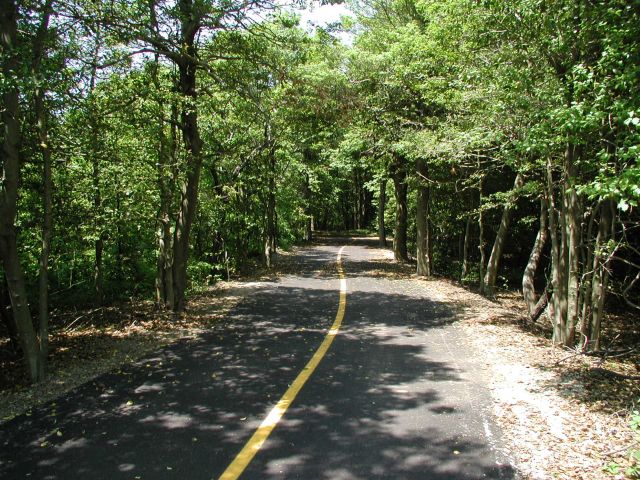
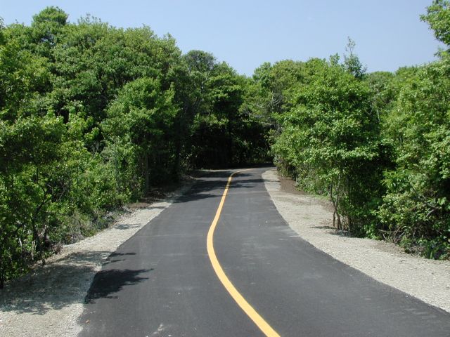
There are small, cool woodsy segments
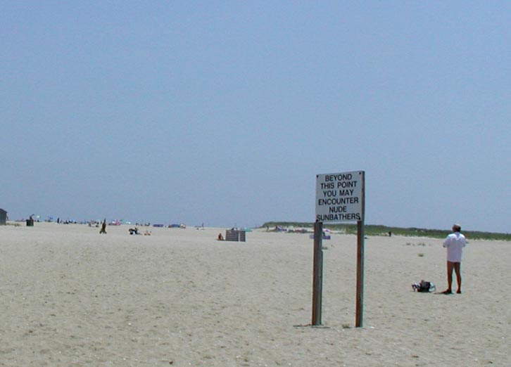
Gunnison Beach -- Clothing optional and almost a half mile wide
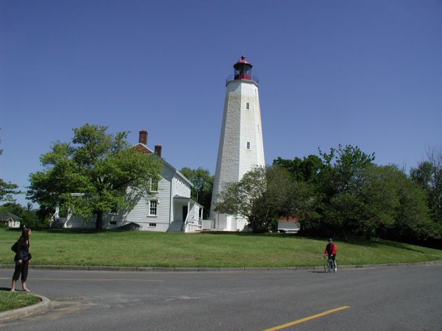
The picturesque Sandy Hook Lighthouse
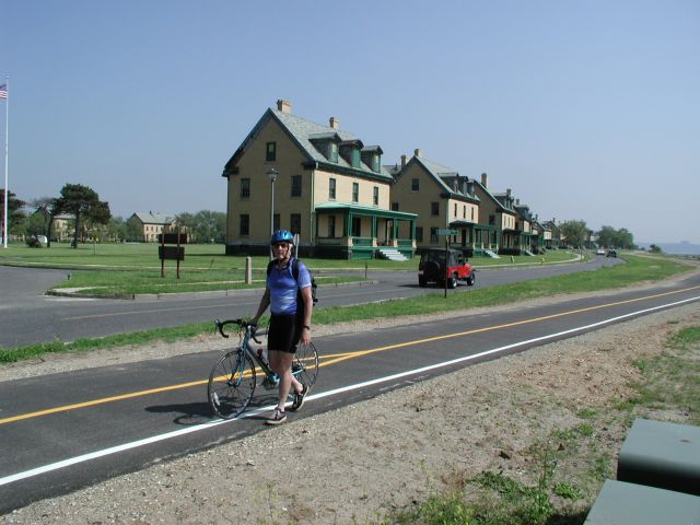
The old officers' houses line the bay at the north end
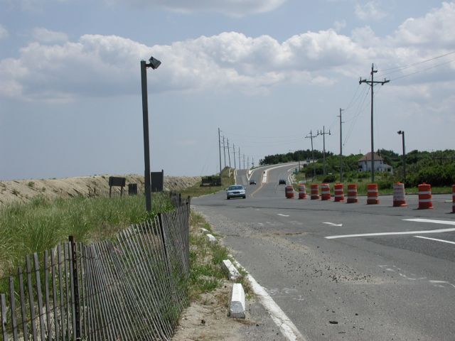
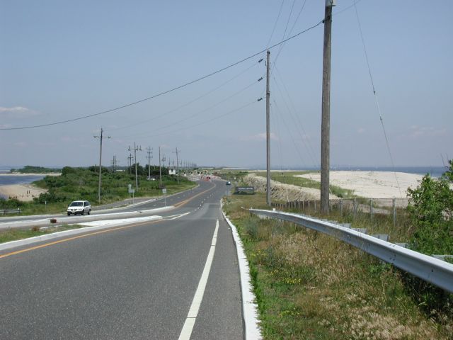
Facing south at the park entrance prior to 2009
In previous versions of this web site I have complained about the danger to cyclists exiting the park, trying to cross lanes in the midst of the brutal traffic on summer weekends. A cyclist trying to exit to the south in the picture above would have to cut across the lanes of traffic while pedaling uphill among drivers that are trying to figure out which lane they are supposed to be in. My own strategy was to go out the "in" lanes on the left of this picture.
However, in 2011 the entrance and exit for bikes either from the south or north was made easy and traffic-free thanks to a new bridge and ramps. As you can see from the picture below, there is an overpass ramp just for pedestrians and bikers coming from, and exiting to, the north. If you come from the south, the bike lanes connect directly to the bike path that runs along the sea wall from Sea Bright.
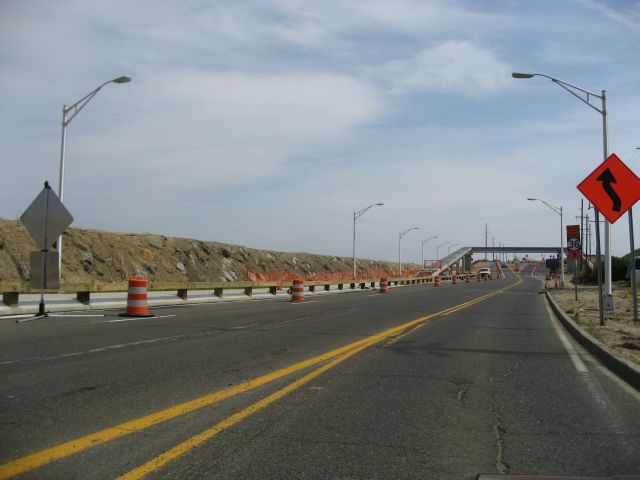
The overpass for pedestrians and bikers opened in spring 2011