Henry Hudson Trail and Bike Path
The Bayshore Trail -- Highlands to Atlantic Highlands
This path was almost completely destroyed by Hurricane Sandy. In the years following the hurricane, the path was reopened, but was virtually unuseable. The following photos show the path in early 2013 after the hurricane, the sign erected in 2014 warning any users, and the beauty of the path before the hurricane. In late 2017 the path was officially recommissioned. As of this writing I have not had an opportunity to revisit the path. My concern would be whether or not the path is now appropriate for use by road bikes.
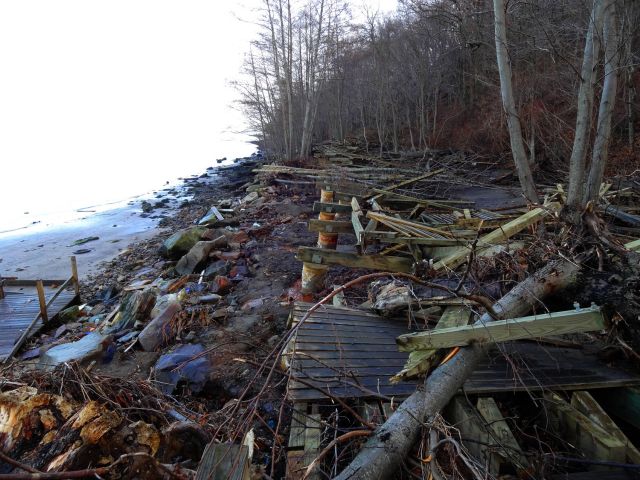
Wreckage of the once-beautiful path
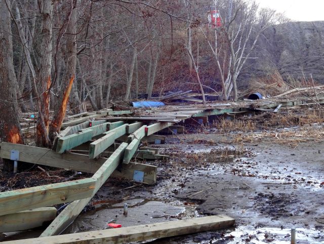
The wooden bridges are gone
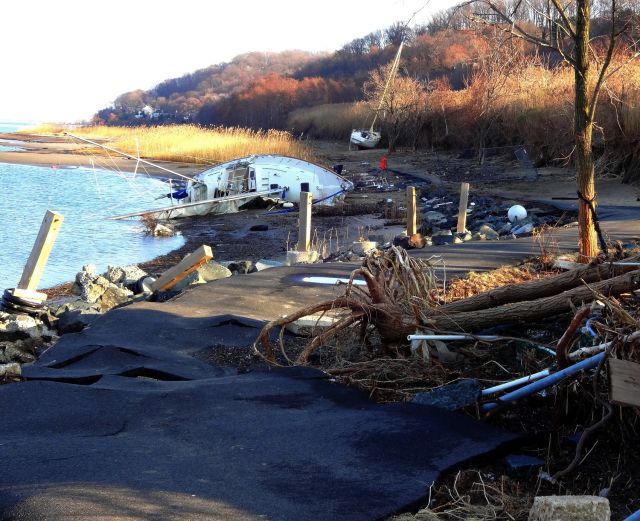
Abandoned boats strewn across the pathway
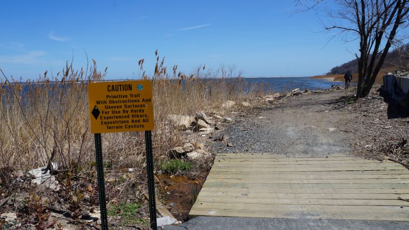
In spring of 2014 a sign warns hikers and bikers
The Bayshore Path
Description:
The Bayshore trail opened in spring 2009. It is only 2 miles in length, running east from the main marina and port at the foot of 1st Avenue in Atlantic Highlands to the beginning of the town center of Highlands at the end of Bayside Drive. In spite of its short length, it is significant in several ways. First, it is quite beautiful -- perhaps the most beautiful part of the entire Henry Hudson trail system. It is nestled delicately at the foot of a very steep, forested hillside, only a few feet away from the water of the Sandy Hook Bay. The other point of significance is that this pathway almost connects the Henry Hudson trail with Sandy Hook (and its bike path). It is only 0.7 miles through residential side streets to the eastern end of the Atlantic Segment of the Henry Hudson Trail, and at the other end of the Bayshore Trail it is only 1.4 miles through the small town of Highlands to the Sandy Hook bridge. Moreover, without this path -- which threads through an inaccessible area -- it would be quite difficult to bike from the Henry Hudson Trail to Sandy Hook without going over big hills and through potentially heavy traffic.
![]()
Connecting between the Henry Hudson Trail and the Bayshore Trail
To connect from the Bayshore Trail to the eastern end of the Henry Hudson's Atlantic Path, follow Bay Ave -- the street at the west end of the Bayshore Trail -- and make a left turn on Avenue D. The Henry Hudson Trail begins just before Avenue D crosses Highway 36. The length of this connection is 0.7 miles, and it is entirely through relatively quiet residential back streets. It is also flat.
It may be seen from the map above that the disused railway tracks, over which the Henry Hudson Trail has been built, does in fact cross between the two current trails. However, it looks like it would be difficult to put the pathway through the various residential, commercial, and parks that have been built in this area since the railroad was abandoned years ago. I actually found that making the transition on the residential streets shown on the map was a nice respite from the usual Henry Hudson scenery, which can be at times almost monotonous in its constancy.
Parking:
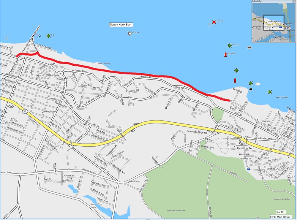
The only parking on the Bayshore Trail is at the two ends of the path. In between, the path is inaccessible, either by car or on foot, unless you are a long distance swimmer or mountain climber. However, there is ample parking at both the east and west ends. At the west end, in Atlantic Highlands, the path ends at the marina, where there is a forest of boats at the north end of 1st Avenue. To many locals this is also known as the location of the Shore Casino -- a restaurant that apparently adopted a hopeful name a long time ago. Also, this is where the ferry service to Manhattan, via the Seastreak Ferry, docks. Needless to say, there are large parking lots here. At the east end, in Highland, the path ends abruptly right where the paved roads begin for the town shopping area. There are several parking lots nearby, and no problem parking on the streets either. The local street at this vacinity has a marked bike lane.
Length:
The path is 2 miles long.
Surface and safety:
The surface is paved for about half the length, on the west end of the path. It is approximately 7 feet wide. On the east end as the path heads into the woods and around the bay, the paving ends and the surface is hard-packed and sandy. As of now the surface is amenable for narrow-tired road bikes, but with more wear and rain, it may become doubtful. For cyclists it is unusually safe, since there is no access for cars and the only pedestrian access is at the two ends.
Points of interest:
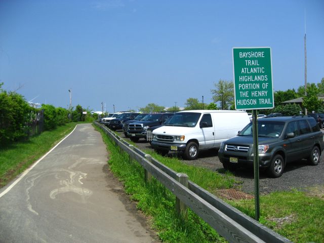
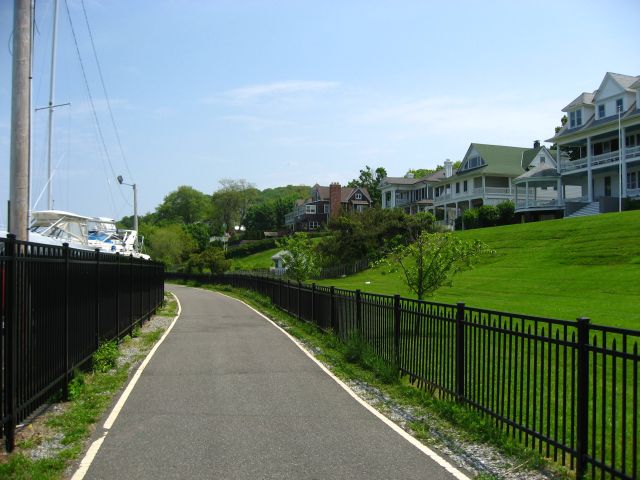
The path is quite beautiful, with the waters of the bay immediately on your left as you head east and the wooded steep hillside on your right. There are architecturally interesting homes built in the woods above the trail. It is said that the highest point on the entire eastern seaboard of the United States is above this path on scenic drive (great views of Sandy Hook and Manhattan there). There are a variety of birds flitting the woods and working the waters of the bay. With the immediacy of the bay, you can smell the water as you bike.
Whats not to like:
Well, of course the trail is too short. However, it can be connected with either the Sandy Hook bike path (1.4 miles east) or the Henry Hudson path (0.7 miles west). Even though the Bayshore Trail has just opened in the spring of 2009, it seems already popular, and mostly with walkers. I suspect that it will become more of a pedestrian path, and depending on the day and season, it may not be easy for cyclists to thread their way through all the walkers. The path is still under construction, which I interpret to mean that the east end will be paved. Meanwhile, I worry that the unpaved surface may become a problem for cyclists, particularly for those with road bikes.
The West end of the Bayshore Trail in Atlantic Highlands
Stately homes at the path's west end overlook the marina
Heading east away from the marina in Atlantic Highlands
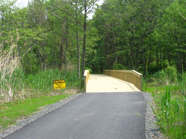
The path heads into a woodsy area over a wooden bridge
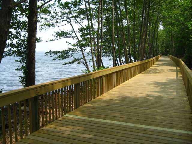
A long bridge with the bay at its edge
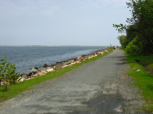
The surface is unpaved as the path opens up and Sandy Hook is visible
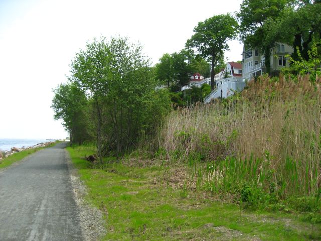
Picturesque homes above the trail
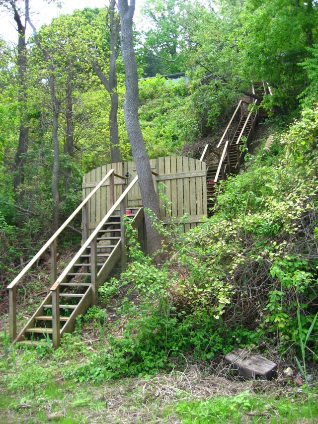
Steep steps to someone's backyard
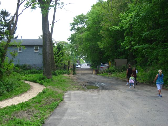
The east end of the trail dumps out onto the streets of Highlands