A Circular Bike Tour of Holland, Day 1
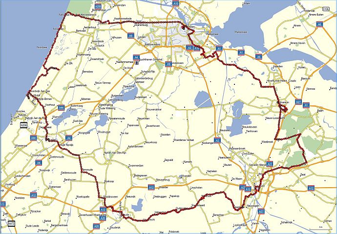
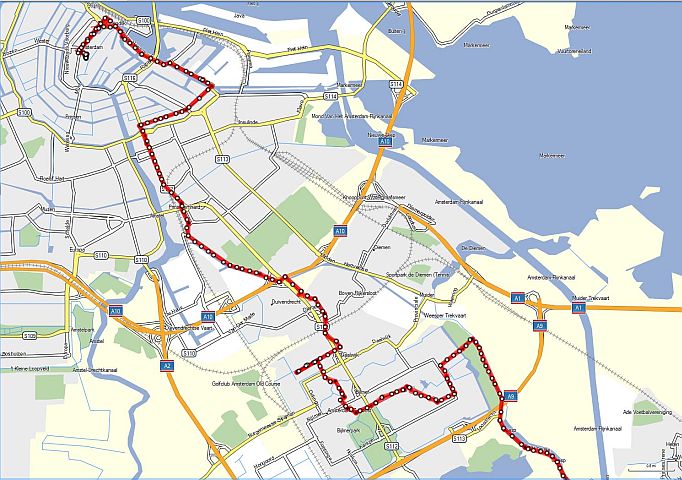
The GPS Track of our Trip (dark red line)
It had been four years since our previous European bike trip, when my biking friend, Len, had had a serious accident coming down a hill into the town of Vicenza in Italy. He vowed never to get on a bike again. That vow lasted three years before he reconsidered in the spring of 2011. I was very happy to hear that once again we would be having a biking adventure.
I suggested that we tour Holland, since that seemed a lot safer than other countries. There were no hills there, so there would be none of the very fast downhill rides that had caused Len's accident in Italy. Also, almost all the cycling would be done on dedicated bike paths and not in traffic. I admit that I favored this myself as it would be a lot easier cycling than in most of our other trips.
Len had one additional rule that he imposed on himself: no GPS on his handlebars. Neither of us knows what really happened on that ill-fated trip in Italy, but we guess that Len took his attention off the road to study the GPS as we approached Vicenza. My own GPS recorded our downhill speed there at 35 mph, which is really, really fast on a bike. Perhaps in that split second of inattention, he had hit the small vertical curb at the side of the road, throwing his bike and himself onto the unforgiving pavement. But we really don't know.
I planned a circular route beginning and ending in Amsterdam, going clockwise so as to finish the circle cycling north up the coast with the wind at our back. I was aided by a Michelin map of the Netherlands, whose main virtue was the underlining of towns that were "worth a visit." I planned the circle to maximize as much as possible the visits to these recommended towns, while keeping the days' distances rather short (25-30 miles) so as to allow for detours on the spur of the moment. The size of the route was limited by the fact that our schedule constaints limited this trip to 5 days, rather than our usual week.
The destinations for each day were as follows:
First day - Amsterdam to Hilversum
Second day - Hilversum to Nieuwegein
Third day - Nieuwegein to Gouda
Fourth day - Gouda to Noordwijk
Fifth day - Noordwijk to Schipol and train to Amsterdam
As the time drew near for our July trip, I decided to further specify our trip by choosing our exact route using the Garmin Mapsource software. I made waypoints for the hotels that Len had booked for us, and then I chose secondary roads to get us between towns. The Mapsource software for routes kept trying to route me onto thruways (A roads), so I had to keep dragging it back to the smaller roads. I uploaded the finished track onto my Garmin eTrex GPS. Now there would be no navigation difficulties. Or so I thought at the time!
Len was flying to Amsterdam from Los Angeles, while I was coming from New Jersey. The thing I most worried about was meeting up at Amsterdam's Schipol Airport. The questions we pondered were where to meet and what to do if something went wrong with our flights. Using an airport map downloaded from the Internet, we chose as a meeting place a Starbucks in the arrivals area. As to what if something went wrong, we never figured that out.
It turned out that both our flights were on time, but when I exited customs and walked into the actual arrivals area, it looked nothing like the simplistic map. It was a chaotic jumble of booths and people. What the map showed as individual stores were actually amorphous areas of the jumble. I gave up on the map and walked aimlessly, but soon did spot a Starbucks (there were two of them), and there was Len sitting on a stool near the edge of the crowd. Was I glad to see him! Now the adventure could begin.
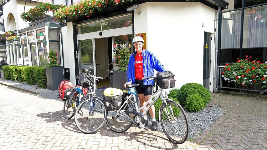
We took turns changing into our biking outfits, and here I am with all of our luggage.
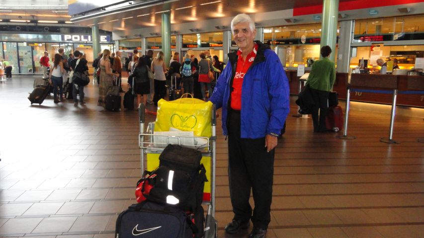
Ready to go at Schipol Airport
After we would finish the bike tour, we had to go to Paris for a meeting, and Len suggested that we should buy our train tickets while we were at the airport. That was a fortunate suggestion, because not only did the train get sold out later, but we were able to get a very favorable price on the tickets.
We took the short train ride from the airport to Amsterdam's Central Station. I suggested that we visit the local tourist store, VVV, that was directly across from the station so as to get advice and better maps for cycling. Unfortunately, it was rather a disappointment, and not so much the VVV's fault as our own. They did have good cycling maps, but there were a couple of drawbacks. While the maps did show the dedicated bike paths (fietspads), it wasn't clear that they showed which ordinary roads had accompanying bike paths. Maybe they did and I just couldn't make out the Dutch on the map. In any event my retrospective opinion is that this information wouldn't have mattered. Almost all roads had bike paths, and if they didn't they didn't need them.
The bigger problem with the cycling maps was that they were expensive. Each covered only a small area, and we would have needed six or seven of them for our trip, at a cost of about $70. Then when I thought about having to get them out and fold and unfold them every time we made a turn, I thought: why bother? We left empty-handed.
Len had reserved bikes at a shop that was said to be a 5-minute walk from the station. Actually it seemed a lot more than that, as we were carrying the awkward panniers and handlebar bags. The shop was on a busy sidestreet (Damstraat) off the main square in Amsterdam.
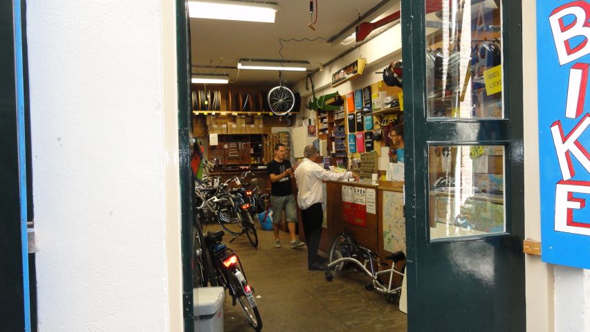
Len Arranges for our Bikes in Amsterdam
We had reserved their best (and most expensive) hybrid bikes. Next door to the shop shown above was a warehouse area that was full of bikes. Clearly, we needn't have reserved bikes, and I'm not even sure that they had paid any attention to our reservation. However, they were very helpful to us as we went through our usual headaches of mounting our gear -- panniers, handlebar bag, GPS, and for Len, his own seat. This took about two hours and was filled with the usual problems. My handlebar bag, for example, wouldn't fit on the handlebars and I ended up letting it droop loosely held by one clamp.
When I went to try a trial ride down the alley, I discovered that the chain was off the sprocket. Of course, the bike had a big mud guard that obscured the chain, and one of the shop people had to go to a lot of trouble to reconnect the chain. In doing so, he noticed that the back tire was in imminent danger of blowing out. So he put a different wheel on my bike. Meanwhile, Len was having other problems, and I was so absorbed in my own difficulties that I don't even know what they were.
We had arrived at the airport around 7:30 am, but it was afternoon before we left the bike shop. Both of our bikes were so heavy that they were barely liftable. It was like driving a tank, but that's the way things are in Holland. Also, we always feel very awkward when first entering traffic on a strange bike loaded down with luggage and equipment. We could barely negotiate the tiny trial runs in the alley way.
So finally we're ready to start our trip. I turned on my GPS and waited for it to find that it was in Holland and to bring up our designated route for the day. But a surprise! When I asked the GPS to navigate the route it said, "Error - no roads near starting point."
"What!!" I screamed at the GPS. How could this be!? We're in the middle of one of the most crowded complex of roads in Europe, and it says there are no roads! But whatever I did, I always got the same error message. Later on, I was able to go onto the Internet and Google this error message. I discovered that many other people got the same error, and no one seemed to know what to do about it. In any event, right from the start all of my route planning was rendered useless. The Mapsource software back in my home computer could navigate the route, but the eTrex could not. So we would wing it.
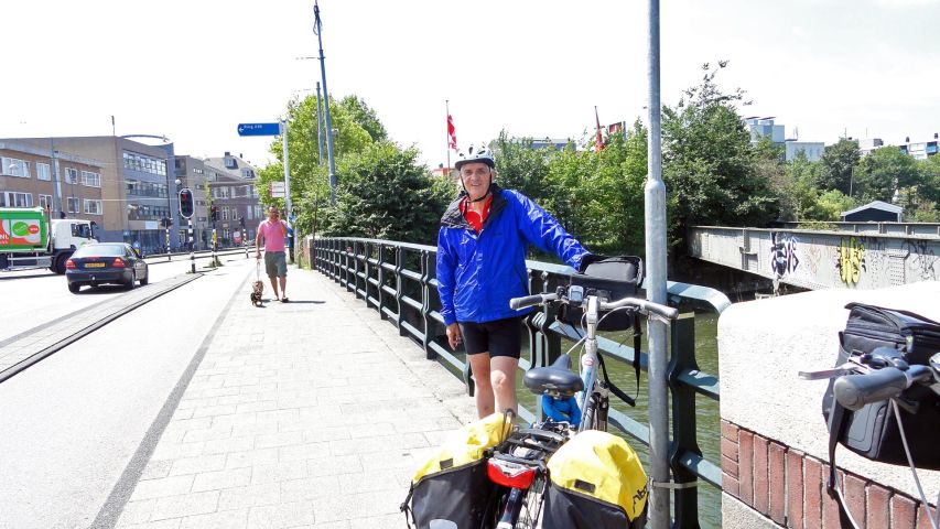
The road we were on as we left the bike shop, Damstraat, was one-way towards the west. We wanted to go east. To bike against traffic on a busy street or not? As awkward as we felt on the bikes at that time, it seemed sensible to go west and circle back to the east where possible. This turned out to be further than we had bargained for, and we were very quickly lost. Not only that, but I was discovering that the derailleur on my bike was so badly adjusted that only one of the 24 gears would stay in position. I was loathe to return to the bike shop, even if we could find it again, so it was apparent that I would have to endure with a single-gear bike. But, I told myself, a lot of people in Holland do just that.
We stopped at a small luncheonette and ate sandwiches at a table on the sidewalk as we tried to figure out where we were and where we should go. It seemed ridiculous, because we had been given a street map of Amsterdam at the bike shop and moreover, we had a GPS. Nonetheless, we hadn't a clue. The map was useless unless we could determine where we were, but the street we were on had no name that we had seen. And the GPS was equally useless, since its tiny screen was impossibly cluttered with city streets.
Lost in Amsterdam
Of course, none of this disheartened us, being a familiar part of the freedom and sense of adventure that comes with starting a cycling trip. We simply started out again, following whatever street it was and before long we found ourselves on the very road that we wanted -- one that would lead us east out of the city. All was well and good. For a while, anyway.
The man at the bike shop had described this road to us. He had gone into great detail, that there would be a detour at such and such a place, and you had to around this or that, and after you passed something else you jogged this way or that, and so forth. Of course we had pretended to understand all this. We had joked later that people giving directions usually see the route clearly in their own minds and believe that you can do the same, which you really can't do.
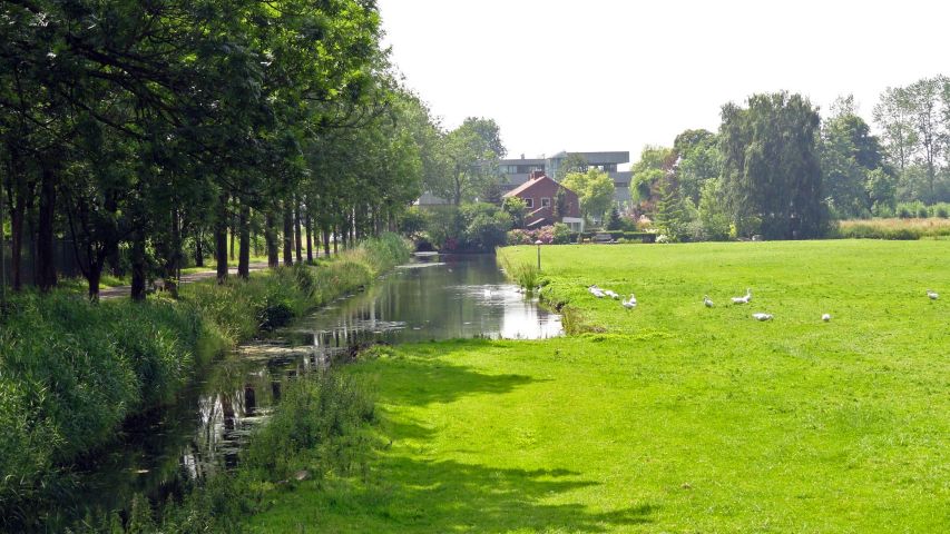
And so we reached a point that seemed to bear some resemblance to something he had described, and there the bike path veered away from the highway we wanted to follow. Soon the highway was lost to view and we were biking towards regions unknown. We were seriously lost again, but we consoled ourselves with the thought that the biking was quite pleasant. We followed a canal for awhile, then through several quiet and beautiful parks, and across the backsides of what looked like factories.
We Bike Aimlessly, but It's Fun
Len seemed to have some sense of the general direction that we wanted, which was more than I could say for myself. But the big problem before us was how to escape to the east through the ring road that circles Amsterdam. Being an A road, it formed an effective moat around the city, which could only be crossed by bike at selected places unknown to us.
Luck was with us. Eventually the bike path we happened to be on went through an underpass and suddenly we were on the actual highway that would take us directly to our destination, Hilversum. Only when I returned home after our trip and uploaded the recorded track from my GPS onto my home computer could I see how we had dithered successfully out of the city.
Our Recorded Track out of Amsterdam
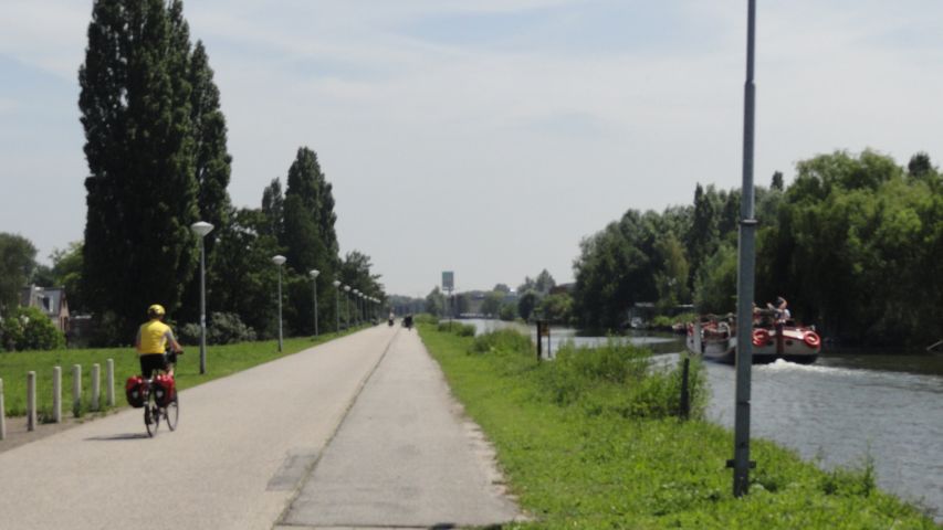
It was now mid-afternoon and after a night without sleep and a substantial time change. But now we were on our way and had only about 13 miles of straight cycling to our hotel. We had left the city world behind and were passing through farmlands. The smells of the pastures and fields permeated the air and brought smiles to our faces.
Cycling Towards Hilversum
A Canal Alongside the Road
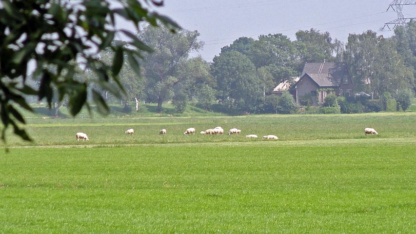
Surrounded by Farmland
There were few other cyclists, but periodically a motorbike would zoom past us, momentarily breaking the serenity we were now enjoying. For the first time the GPS on my handlebars was becoming useful. It couldn't navigate the route I had saved, but I still had the waypoints for all of our hotels. The GPS would at least show me the direction and distance to those stopping points. Endpoint navigation, at least, was easy. And so we arrived without further difficulty at the Tulip Inn in Hilversum.
The Tulip Inn, Hilversum
At the inn, we locked our bikes together in their garage. I should mention something about the locks that came with our bikes. They were really formidable, and I think that it would have taken an oxacetalene torch to cut through the heavy steel chain. Moreover, the way the system worked was that when you removed the key from the clamp around the back wheel, the wheel was automatically locked by a clasp across the spokes. Then you used the key on the padlock for the chain. Even so, we had been advised to buy insurance in the event that the bikes were stolen. We did, but agreed later it had been a waste of money.
Len asked the desk clerk at the inn what there was in Hilversum to be seen. After a moment's thought, he told us that we should see the city hall, which was a couple of blocks walk from the inn. So after an hour or so of rest we walked in that direction. We found a large modern building with a carillon tower that looked like a school.
"Is this it?" I asked rhetorically. If this was the best tourist attraction they had, then we might as well retire back to the hotel. We asked a passerby if that was the city hall, and he affirmed that it was. Asked about a restaurant, he told us that there were two town squares down the road that had various restaurant choices. We walked that way.
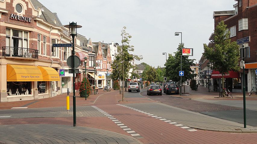
Town Square in Hilversum
In the second town square we chose an upscale Italian restaurant and had a pleasant meal. As we walked back to our hotel I was impressed with the sense of serenity in the town. It was quiet and very well manicured everywhere. There was little auto traffic, but cyclists would pass us by periodically. It seemed that they were almost all pretty young girls, sitting upright on their bikes with their blond hair streaming behind them. All in all, it was a beautiful setting.
Here, finally, is the recorded GPS track for the first day of the trip, from Amsterdam to our hotel in Hilversum.
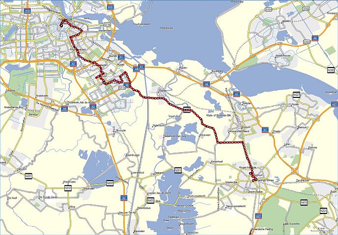
Our GPS Track for Day 1 - Amsterdam to Hilversum